Connecticut
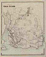
Reproductions of old maps of towns and villages in Connecticut, from county atlases published in the late 1800s. Most maps show the family name on each house.

Also shown: schools, factories, railroad tracks and stations, churches, saw- and grist-mills, etc. Maps are available from these county atlases:
Old New London County maps from the Atlas of New London County, published in 1868 by Beers, Ellis & Soule
Old New Haven County maps from the Atlas of New Haven County, published in 1868 by F. W. Beers
Old Old Hartford County maps from the Atlas of Hartford & Tolland Counties, published in 1869 by Baker & Tilden
Old Tolland County maps from the Atlas of Hartford & Tolland Counties, published in 1869 by Baker & Tilden
Old Litchfield County maps from the Atlas of Litchfield County, published in 1874 by F. W. Beers
Old Fairfield County maps from the Atlas of New York & Vicinity, published in 1867 by Beers, Ellis & Soule
Old Middlesex County maps, from the Atlas of Middlesex County, published in 1874 by F. W. Beers
Old Windham County maps from the Atlas of Windham County, published in 1869 by Gray
| Categories |
|---|
Maps for Genealogy: Old maps of Fairfield County towns, reproduced from the Atlas of new York & Vicinity, published in 1867 by Beers, Ellis & Soule.
|
|
|
|
|
|
|
Old maps of New London County towns
|
|
|
|
|
| Products |
|---|
|
Voluntown map
Historical town map of Voluntown, Connecticut (CT), reproduced from the Atlas of Windham County, Connecticut (CT), published by Gray in 1869.
$15.00 - $21.00
|
|
Historical town map of Sterling, Connecticut (CT), reproduced from the Atlas of Windham County, Connecticut (CT), published by Gray in 1869.
$15.00 - $21.00
|
|
Historical town map of Plainfield, Connecticut (CT), reproduced from the Atlas of Windham County, Connecticut (CT), published by Gray in 1869.
$15.00 - $21.00
|
|
Historical town map of Central Village, Almaville, Moosup, Uniondale, Connecticut (CT), reproduced from the Atlas of Windham County, Connecticut (CT), published by Gray in 1869.
$15.00 - $21.00
|
|
Reproduced from the Atlas of Windham County, published by Gray in 1869
$15.00 - $21.00
|
|
Historical town map of Killingly, Connecticut (CT), reproduced from the Atlas of Windham County, Connecticut (CT), published by Gray in 1869.
$15.00 - $21.00
|
|
Historical town map of Westfield village, Connecticut (CT), reproduced from the Atlas of Windham County, Connecticut (CT), published by Gray in 1869.
$15.00 - $21.00
|
|
Reproduced from the Atlas of Windham County, published by Gray in 1869
$15.00 - $21.00
|
|
Historical town map of Putnam, Connecticut (CT), reproduced from the Atlas of Windham County, Connecticut (CT), published by Gray in 1869.
$15.00 - $21.00
|
|
Historical town map of Putnam, Connecticut (CT), reproduced from the Atlas of Windham County, Connecticut (CT), published by Gray in 1869.
$15.00 - $21.00
|
|
Historical town map of Pomfret, Connecticut (CT), reproduced from the Atlas of Windham County, Connecticut (CT), published by Gray in 1869.
$15.00 - $21.00
|
|
Historical town map of Thompson, Connecticut (CT), reproduced from the Atlas of Windham County, Connecticut (CT), published by Gray in 1869.
$15.00 - $21.00
|
|
Historical town map of Thompson and New Boston, Connecticut (CT), reproduced from the Atlas of Windham County, Connecticut (CT), published by Gray in 1869.
$15.00 - $21.00
|
|
Historical town map of Woodstock, Connecticut (CT), reproduced from the Atlas of Windham County, Connecticut (CT), published by Gray in 1869.
$15.00 - $21.00
|
|
Historical town map of Scotland, Connecticut (CT), reproduced from the Atlas of Windham County, Connecticut (CT), published by Gray in 1869.
$15.00 - $21.00
|
|
Historical village map of Woodstock, Connecticut (CT), reproduced from the Atlas of Windham County, Connecticut (CT), published by Gray in 1869.
$15.00 - $21.00
|
|
Reproduced from the Atlas of Windham County, Connecticut (CT), published by Gray in 1869
$15.00 - $21.00
|
|
Historical town map of Brooklyn village and Canterbury village, Connecticut (CT), reproduced from the Atlas of Windham County, Connecticut (CT), published by Gray in 1869.
$15.00 - $21.00
|
|
Historical town map of Canterbury, Connecticut (CT), reproduced from the Atlas of Windham County, Connecticut (CT), published by Gray in 1869.
$15.00 - $21.00
|
|
Historical town map of Windham, Connecticut (CT), reproduced from the Atlas of Windham County, Connecticut (CT), published by Gray in 1869.
$15.00 - $21.00
|
|
Historical town map of Hampton, Connecticut (CT), reproduced from the Atlas of Windham County, Connecticut (CT), published by Gray in 1869.
$15.00 - $21.00
|
|
Historical town map of Ashford, Connecticut (CT), reproduced from the Atlas of Windham County, Connecticut (CT), published by Gray in 1869.
$15.00 - $21.00
|
|
Historical town map of Eastford, Connecticut (CT), reproduced from the Atlas of Windham County, Connecticut (CT), published by Gray in 1869.
$15.00 - $21.00
|
|
Historical town map of Chaplin, Connecticut (CT), reproduced from the Atlas of Windham County, Connecticut (CT), published by Gray in 1869.
$15.00 - $21.00
|
|
|
 Old Maps of New England & New York


