Middlesex County Maps
Maps reproduced from the 1875 Atlas of Middlesex County, Massachusetts, published by F. W. Beers.
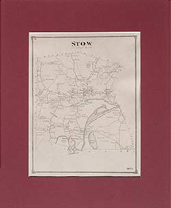
1875 Map of Stow
Middlesex County, MA
| Products |
|---|
|
This reproduction shows the Dorchester area from a larger map in the 1889 Atlas. No family names.
$15.00 - $21.00
|
|
This is mainly a map of the Boston harbor, the coast and islands from north of Nahant to Rainsford or Hospital Island on the south, with Cambridge and Brookline on the west. No family names.
$15.00 - $21.00
|
|
Cambridge map, Massachusetts
Old map of Cambridge, Massachusetts (MA). Corrected & Prepared by J. G. Chase, Civil Engineer. No family names.
$15.00 - $21.00
|
|
|
 Old Maps of New England & New York